The Peter C Fisher Gallery online is now open! Our physical, Orcas Island location at Grindstone Harbor is slated to open before the end of 2026.
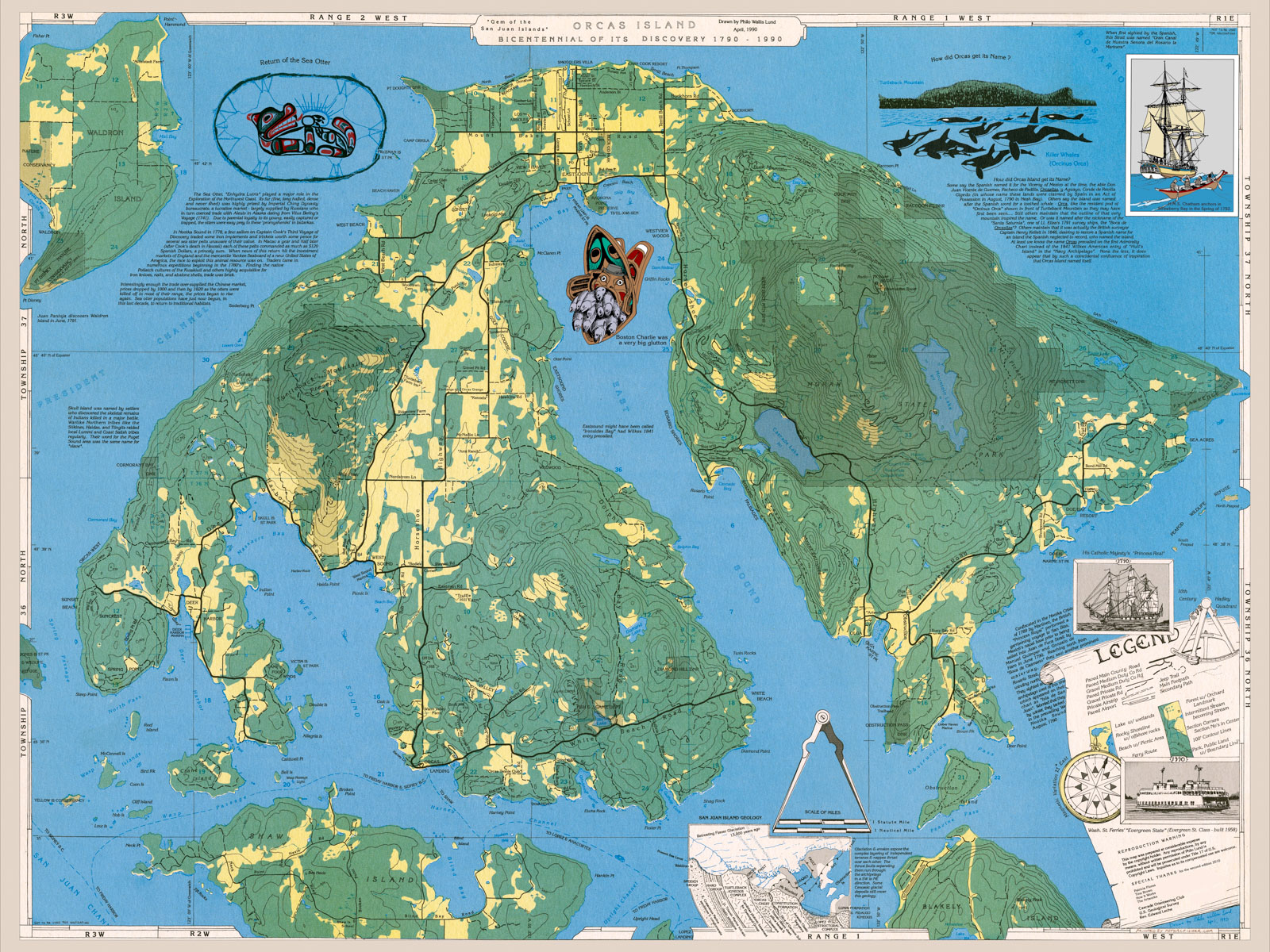
Bicentennial map of orcas island by Philo Lund. Drawn in 1990 and updated in 2010. This colorful map shows, public and private Roads, topo and interesting island history. Photo © copyright by Peter C Fisher.